DockNav IQ

DOCKNAV IQFROM HIGHWAY TO GATECOMMERCIAL NAVIGATION

Navigation built for the whole run.

Truck navigation shouldn't end at a street address.

DockNav combines commercial routing, Facility Intelligence, live road information and driver-powered intelligence to help drivers navigate from the highway to the correct truck entrance, gate, staging area and dock.
On this page: In the app Beta In development
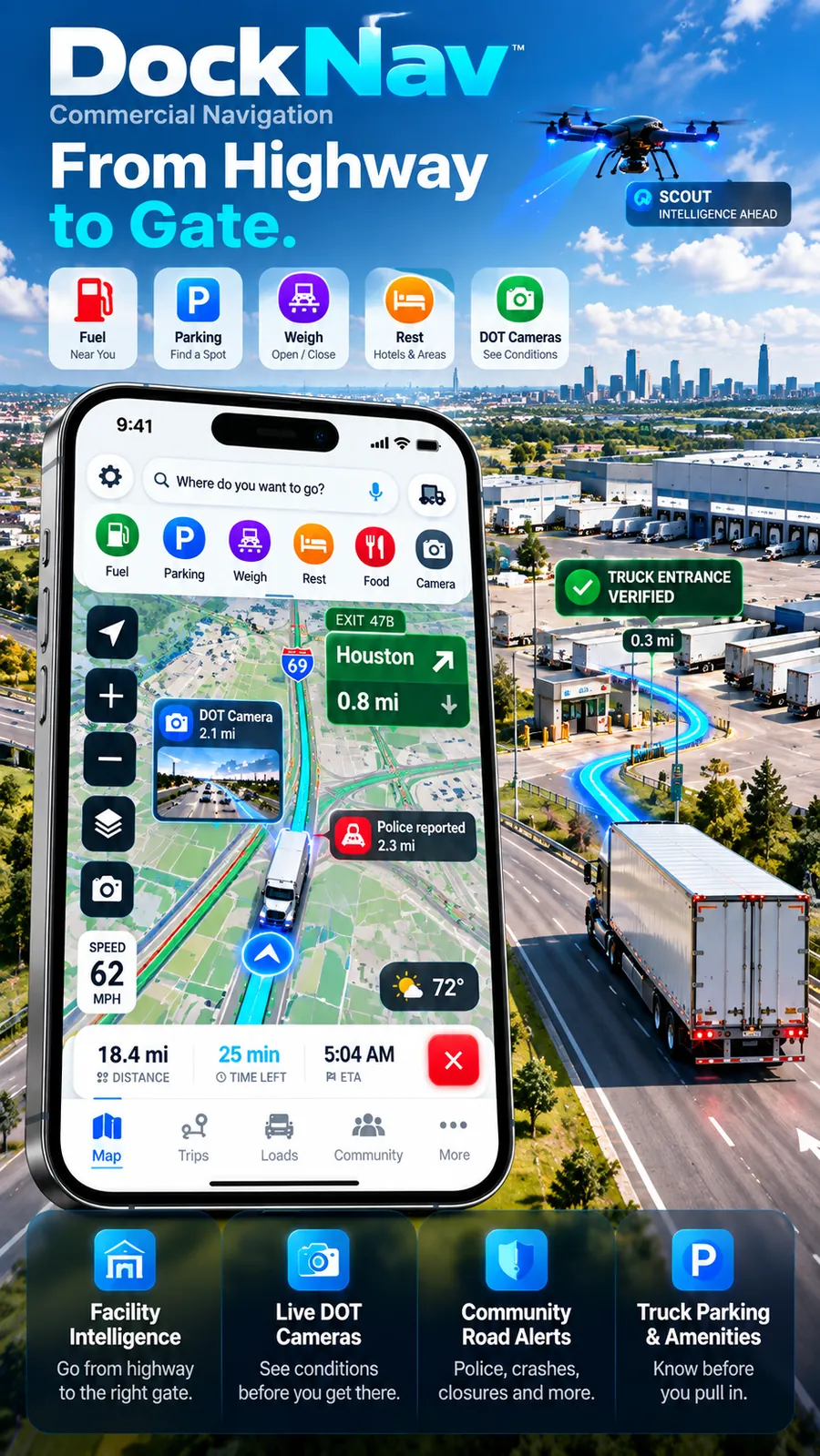
DockNav marketing artwork: a phone showing truck navigation with fuel, parking, weigh station and camera shortcuts, beside a truck following a cyan route to a verified truck entrance at a distribution center.

Illustration

The DockNav difference

The street address isn't the finish line.

Traditional navigation can get a driver to the property. DockNav is being built to help with what happens next.
  1. 01
    HighwayTruck routing for your vehicle profile
  2. 02
    Truck approachThe roads a truck actually takes in
  3. 03
    Verified entranceThe commercial truck entrance, confirmed by drivers
  4. 04
    GateWhere to pull up and what to expect
  5. 05
    Guard shackCheck-in information from drivers
  6. 06
    StagingWhere to wait before entering the yard
  7. 07
    DockDock entrance and yard flow
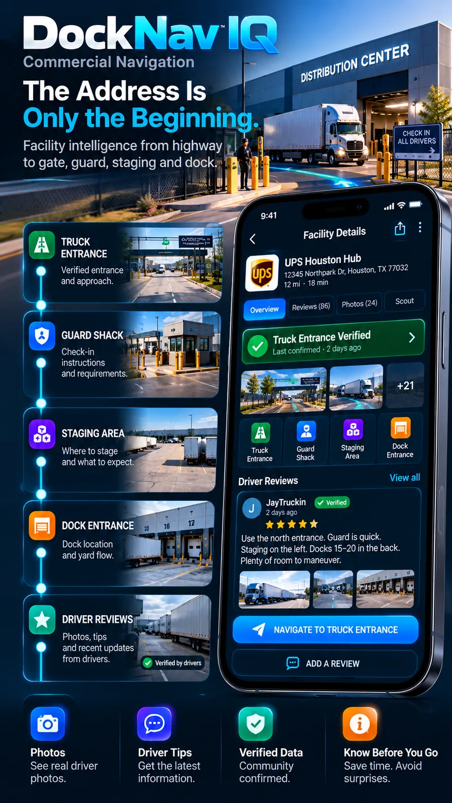
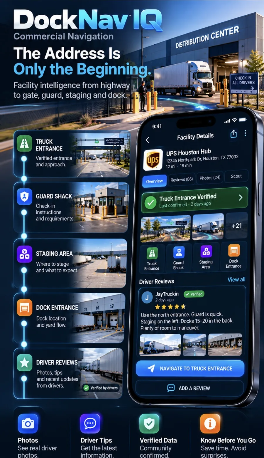
DockNav Facility Intelligence artwork: a facility details screen with a verified truck entrance, guard shack, staging and dock entrance, alongside photos of each stage of a distribution-center arrival.

Illustration · example facility, not a real listing

Facility Intelligence In the app

Know where to go before you arrive.

Arrival details are built by drivers, facility by facility, and every detail shows how much it can be trusted.

Verified truck entrances

Find the commercial entrance instead of blindly following the street address.

Guard shack information

Know what comes after the gate.

Staging information

See available arrival information before entering the yard.

Dock / arrival guidance

Continue the arrival workflow beyond the front gate.

Facility photos

See driver-contributed entrance and facility photos.

Trust status

Every detail is labelled. Nothing is called verified unless drivers confirmed it.

✓ VERIFIEDCOMMUNITYNO DATA
DockNav technology Beta

D-NAV™

Next-generation truck routing intelligence.

Built specifically for commercial navigation, D-NAV combines truck-profile constraints, route conditions, verified road intelligence and DockNav's routing logic to evaluate the road ahead, not just calculate the shortest line between two points.

ADVANCED COMMERCIAL ROUTING ENGINEREAL-TIME ROUTE INTELLIGENCETRUCK-PROFILE-AWARE DECISIONINGVERIFIED ROAD INTELLIGENCEDYNAMIC REROUTING
  1. 01Truck profileHeight, weight, length, axles, hazmat
  2. 02Route candidatesLegal truck routes from the routing provider
  3. 03Live + verified intelligenceClosures, work zones, incidents, confirmed driver reports
  4. 04D-NAV analysisEach candidate is scored against what's known, and what isn't
  5. 05Recommended routeWith the reasons, in plain words
FASTEST⚠ Crosses a verified full closure. The closure isn't in this ETA.
4 h 12 mon paper
SHORTESTFewest miles for your truck. Also crosses the closure.
231 mi4 h 31 m
D-NAV BETA RECOMMENDEDGoes around the closure. A time you can actually drive.
4 h 19 mopen route

WHY THIS ROUTE?

✓ VERIFIED CLOSURE AHEAD

D-NAV found that the provider's fastest route crosses a verified closure, so it picked an alternative.

  • On paper, FASTEST is 7 minutes quicker. But its 4 h 12 m assumes the closed road is open, so it isn't really the fastest anymore.
  • D-NAV's 4 h 19 m is the provider's own estimate for a route that's open.
  • Every candidate keeps your truck's height, weight and hazmat limits.
  • Missing data is reported as missing, never as "clear".
D-NAV BETAAlso the fastest route
3 h 05 m

When nothing on the fastest route needs avoiding, D-NAV agrees with it and says so. It never makes up a better time.
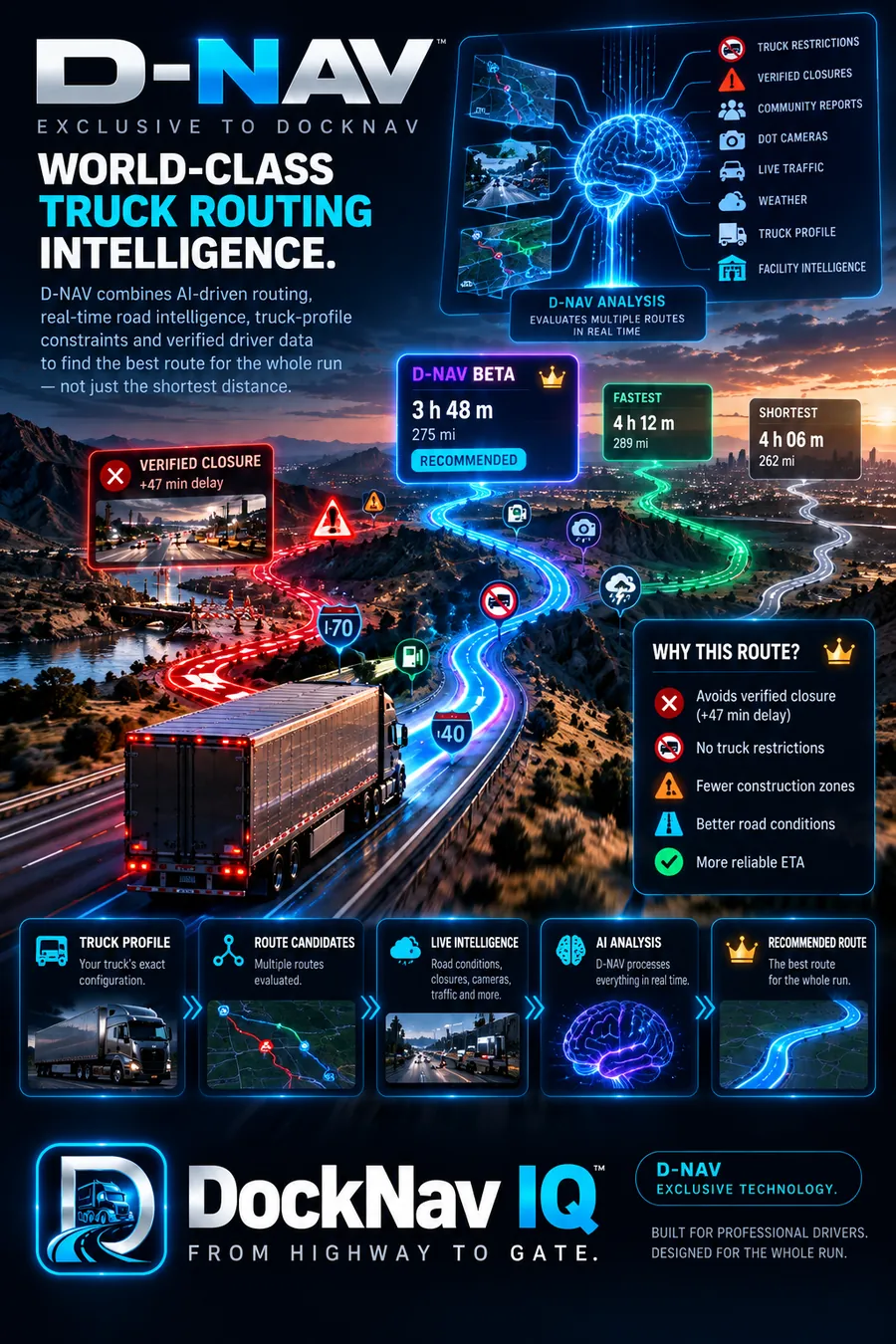
D-NAV concept poster: a truck on a mountain highway with three glowing route options, a verified closure on one, and a Why this route panel.

Concept artwork · times and labels in it are not real results

Example values. FASTEST and SHORTEST are always the provider's own routes. D-NAV only chooses between legal truck routes, and it can't guarantee a route free of every restriction or hazard. Always follow posted signs.

Live DOT cameras In the app

Don't just hear about the road. See it.

DockNav surfaces only the cameras along your active route, in the order you'll reach them, instead of covering the map with every camera in the state.
  • Route-bound camera pins and an upcoming-camera reel
  • Distance ahead on every camera
  • Snapshots, plus live video where the state provides it
  • Source credited to the state DOT / 511 system; coverage depends on what each state publishes

CAMERAS AHEAD

Illustration
SNAPSHOT
2.4 MII-69 N at exit 47B
Source: state DOT
LIVE
7.1 MII-610 interchange
Source: 511
SNAPSHOT
18.0 MIUS-59 S overpass
Source: state DOT
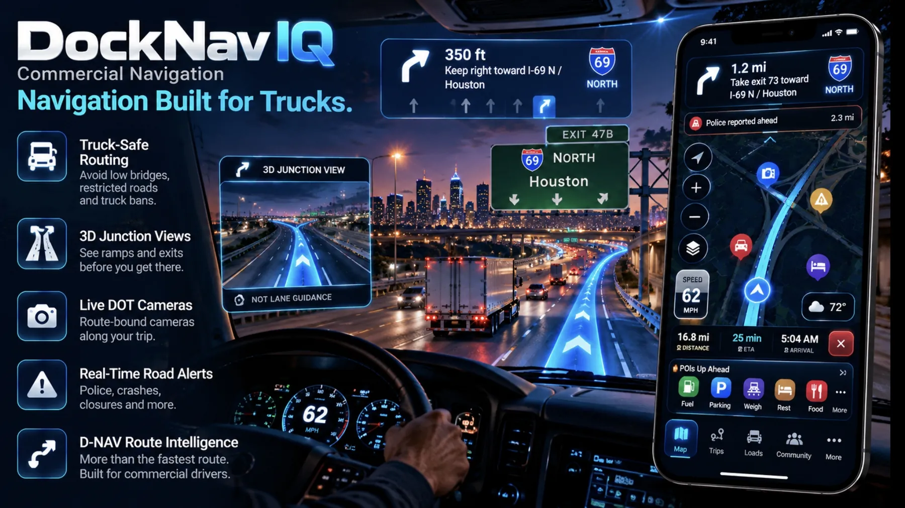
DockNav artwork from a truck cab: a phone on the dash shows the route, a junction view and a live DOT camera, with a police-reported-ahead alert floating over the highway.

Illustration

Community road intelligence In the app

Drivers know what's ahead.

CRASHHAZARDCLOSURECONSTRUCTION DISABLED VEHICLETRUCK RESTRICTIONPOLICESPEED CAMERA
ReportedA driver reports it, by voice or with a couple of taps
Drivers confirmApproaching drivers are asked about it
Still there / not thereConfirmations keep it alive; "not there" votes count against it
Ages outUnconfirmed reports expire on their own

DockNav isn't trying to be a social-media app. There are no followers or likes, just driver-powered road intelligence that stays fresh or disappears.

Truck profile In the app

Your truck. Your route.

Your vehicle's configuration goes into every truck route request, so DockNav can ask for and evaluate routes that suit that profile wherever the routing data supports it.

Routing data can't cover every low bridge or posted restriction. Always follow posted signs.
Truck profile

Example
HEIGHT13'6"
WEIGHT80,000 LB
TRAILER53'
AXLES5
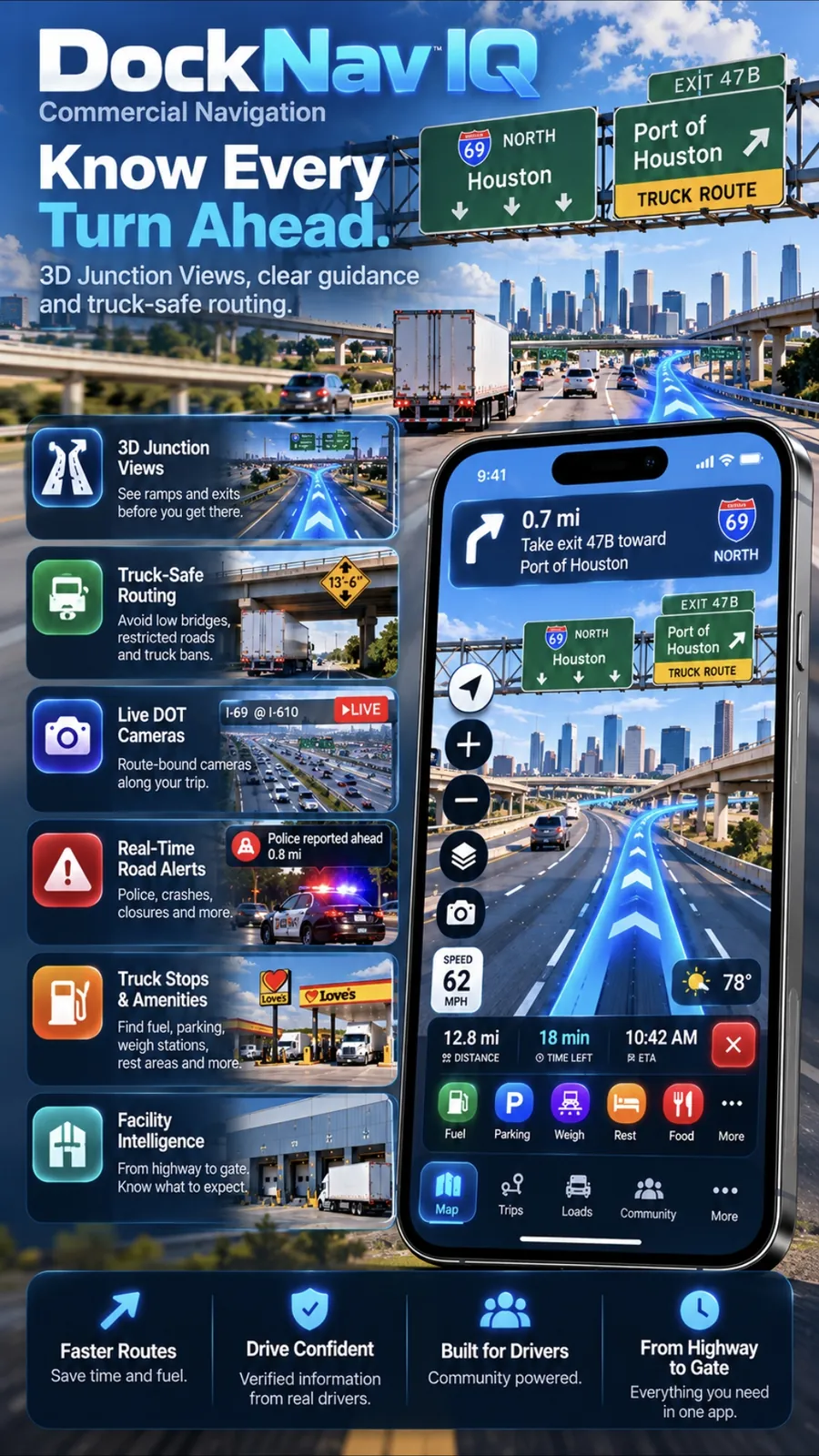
DockNav artwork: a junction view of exit 47B toward the Port of Houston with green highway signs, a highlighted route path and a maneuver card reading 0.7 miles, take exit 47B.

Illustration

Junction View In the app

See the exit before you're in it.

Major maneuvers get a clear sign-style view: the upcoming exit, the highway sign, the route path and the maneuver itself, sized to read at a glance.

NOT LANE GUIDANCE

Junction View shows the maneuver, not which lane to be in. Our routing data doesn't include lane information, so DockNav never pretends to have it.

Up Ahead In the app

What matters next, in one place.

The active-navigation tray lists what's coming on your route, ordered by distance ahead instead of scattered across the map: fuel, parking, weigh stations, rest areas, construction, restrictions, road alerts and the cameras ahead.

UP AHEAD

!
Construction · right laneRoad alert
3.2 mi
⛽
Fuel · truck lanesExit 52
8.6 mi
W
Weigh stationStatus: open · reported 20 min ago
14.1 mi
P
Truck parkingRest area
27.5 mi
⚠
Truck restrictionPosted height limit on alternate road
31.0 mi

CAMERAS AHEAD

◉
3 cameras on routeNext one in 2.4 mi
›

Rest area · I-80 E

Example
COMMUNITYNOT LIVE OCCUPANCY
LAST REPORT5+ open
REPORTED38 min

Reports fade with time, so an old report never looks fresh. Amenities come from the facility listing.

Truck parking In the app

Plan the stop before the clock forces it.

See parking information, recent driver reports and facility amenities before you commit to a stop.

In developmentHistorical parking trends, once there's enough real data

Parking information is reported by drivers and is never a guarantee that a space will be open.

Route Lab In the app

Build the run, not just the next stop.

BUILD YOUR RUNMULTI-STOP ROUTESREORDER STOPSCOMPARE ROUTESTRUCK / CAR LEGS

Lay out every stop, set each leg to truck or car, compare route options for every leg, then download the whole run for areas with no service.

Build your run

Example
1
Shipper pickupLeg 1 · 142 mi
TRUCK
2
Drop yardLeg 2 · 88 mi
TRUCK
3
Hotel, bobtail to dinnerLeg 3 · 4 mi
CAR
DockNav technology In development

SCOUT™

See beyond the route.

Road intelligence ahead

SCOUT gives drivers a clearer picture of what's developing ahead of the truck, bringing relevant road, camera, traffic and route intelligence forward before it becomes the driver's problem.

  1. 01SCOUT detectsSomething is developing ahead on the route
  2. 02D-NAV evaluatesIs there a better legal truck route?
  3. 03Driver stays informedA clear alert with the reasons, and the driver decides
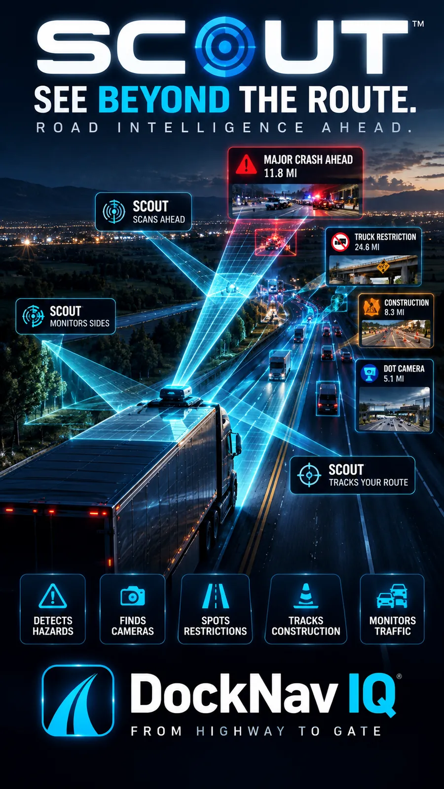
SCOUT concept poster: a truck at night with cyan scanning beams reaching down the highway, finding a major crash 11.8 miles ahead, a truck restriction, construction and a DOT camera.

Concept visualization · SCOUT is software, with no drone or vehicle sensor

ROAD ALERT · 11.8 MI Major crash ahead Confirmed by drivers ahead
D-NAV BETA Alternative route available Goes around the crash on a legal truck route
WHY THIS ROUTE?TAKE IT

Illustration of the driver-facing result

What SCOUT brings forward

  • Route-ahead intelligenceIn the app
  • DOT Cameras AheadIn the app
  • Community road reportsIn the app
  • Closures and constructionIn the app
  • Truck restrictionsIn the app
  • Traffic conditionsIn the app
  • Facility approach intelligenceIn the app

These sources already run in DockNav today. SCOUT, a single experience that watches all of them ahead of the truck and surfaces what matters, is in development; in the current app it's a visual preview.

The DockNav intelligence stack

Four layers. One run.

  1. SCOUT™Sees what's developing ahead.
    In development
  2. D-NAV™Evaluates the route.
    Beta
  3. UP AHEADKeeps the driver informed.
    In the app
  4. FACILITY INTELLIGENCETakes navigation from highway to gate, guard, staging and dock.
    In the app

DOCKNAV

From highway to gate.

Driver contributions

Built with drivers. Improved by drivers.

What counts here is trust, freshness and verification, not likes or followers.

Gate photos

Every photo is screened automatically, and reported photos are hidden while they're reviewed.

Facility corrections

Fix a wrong entrance or dock, and other drivers confirm it.

Parking information

Quick space reports that fade with time.

Road reports

Hazards, closures and more, confirmed or cleared by drivers behind you.

Confirmations

One driver, one vote. Your own report never confirms itself.

Arrival information

Guard shack, staging and dock details for the next driver in.

DockNav IQ

One app. The whole run.

Beta

D-NAV

Smarter route intelligence

In the app

Facility Intelligence

Highway-to-gate arrival information

In the app

DOT Cameras

Relevant cameras along your route

In the app

Community

Driver-powered road intelligence

In the app

Truck Profile

Navigation built around your vehicle's configuration

In the app

Parking

Plan stops with better information

In the app

Junction View

Clearer major maneuvers

In the app

Route Lab

Build and compare complex runs

Your run doesn't end at the highway. Neither should your navigation.

DOCKNAV IQFROM HIGHWAY TO GATE

Coming to theApp Store
Coming toGoogle Play

Want to know the day DockNav launches, or join the beta? Email us:

support@docknaviq.com